The Golis Mountains: Somaliland’s Northern Escarpment
The Golis Mountains rise between Somaliland’s hot coastal plain and its cooler plateau. Here is where they run, what grows on their misty slopes, and what lives among their rocks.
NATURE · LANDSCAPES
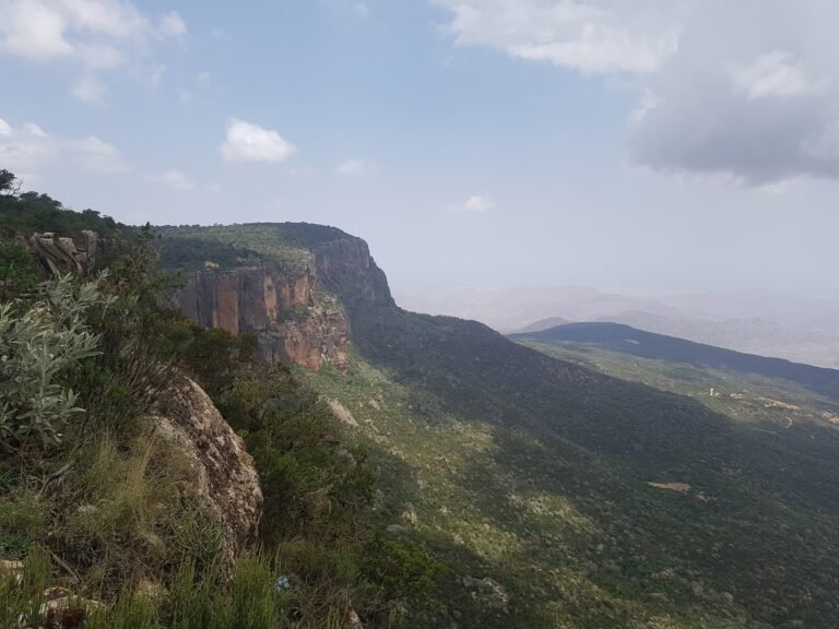
Drive south from Berbera and the flat coast soon ends. About 46 km out, at the village of Laaleys, the road starts to climb into the mountains, and the landscape quickly becomes greener. These are the Golis Mountains, the steep northern edge of Somaliland’s high plateau.
Where are the Golis Mountains?
Somaliland’s highlands run parallel to the Gulf of Aden. Wikipedia’s geography article puts it simply: to the west are the Golis Mountains, and to the east the Ogo Mountains. The Golis run through the Togdheer region and end near Gaan Libah.
Strictly speaking, they are not a separate range. Wikipedia describes the Golis as the jagged northern edge of the Somali plateau, rather than a mountain range in their own right. The name has also stretched over time. Since the civil war, the wider Karkaar mountains are often called the Golis Mountains too.
Ecologists group the area with its eastern neighbours. The Golis and Ga’an Libah form the western portion of the Somali montane xeric woodlands ecoregion. The Cal Madow mountains, around Daallo, form its eastern part.
How high are the Golis Mountains?
Heights vary from source to source, so treat single figures with care. Wikipedia’s Golis article gives the highest point as 1,371 metres. Yet its article on Sheikh puts the pass on the main road at about 1,490 metres, which is higher.
Nearby Gacan Libaax (Ga’an Libah) rises further. A 2007 study by the Hargeisa-based group Candlelight gives its altitude as about 1,719 metres. Somaliland’s highest summits lie further east, in the Cal Madow range; our guide to the Daallo mountains covers them.
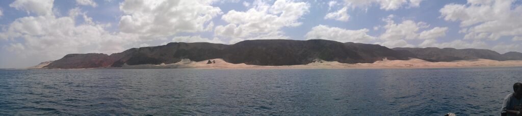
Between the Guban and the plateau
The Golis divide two very different worlds. Below them lies the Guban, a coastal plain running from Zeila to Berbera. Britannica describes it as hot and humid, with about 50 mm of rain a year and sparse steppe vegetation.
Above the escarpment, conditions change. The highland and plateau regions receive 300–600 mm of rain a year, and most of the country’s rainfall falls there. Temperatures drop too. Across the wider ecoregion, mountain temperatures range from 9°C to 21°C, compared with 21°C to 30°C in the lowlands.
Mist matters as much as rain. At Gacan Libaax, the Candlelight study records mist from roughly November to February. It also cites a historical mean of 650 mm of rain a year for the mountain.
The main rains follow two seasons. The Gu, the longer wet season, lasts from late March to early June. The shorter Deyr runs from late September through November.
Mist forests and juniper
The slopes facing the sea hold some unusual woodland. In a 2010 report, The World described how, in the mist forests of the Golis Mountains, clouds roll in off the sea. It quoted a United Nations Environment Programme study calling these mist forests the only true forest areas of Somalia.
Higher up, the trees change. Across the ecoregion, remnant woodlands of juniper (Juniperus procera) and olive (Olea europaea) grow at the highest elevations. Giant succulents, including Euphorbia abyssinica, grow on the escarpment. At Gacan Libaax, the Candlelight study lists juniper, Buxus hildebrandtii and Dracaena ombet among the forest’s plants.
Frankincense and myrrh trees
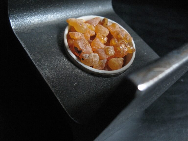
The Golis are also resin country. According to The World, myrrh trees (Commiphora myrrha) grow on the lower slopes, while frankincense (Boswellia carteri) grows at higher altitudes. A third tree, Boswellia frereana, gives a white frankincense known as maidi, popular as a chewing gum in the Arab world.
These trees grow on farms owned by smallholders. Harvesters cut the bark and let the gum seep out, then collect it over several weeks. The gum then travels to the main market at Burao, and on to Berbera port for export. For the ancient side of this trade, read our story on frankincense, Somaliland and Rome.
Wildlife of the range
The cliffs suit animals that like steep ground. A 2015 IUCN report found the beira, a small antelope with large ears, widely but thinly spread across the plateau hills and the Golis range. The same report places the klipspringer on steep slopes along the main mountain range.
At Gacan Libaax, recorded mammals include the hamadryas baboon, klipspringer, beira and dorcas gazelle. Birds include the sombre rock chat and the Somali golden-winged grosbeak, and BirdLife lists the area as an Important Bird Area. Our guide to the birds of Somaliland has more.
Pressures on the mountains
These forests face real strain. The World reported that climate change thins the clouds of moisture that blow in from the Gulf of Aden, and that people cut trees for charcoal.
The Candlelight study adds overgrazing, charcoal production and qat cultivation to the list. It also offers a hopeful example. At Gacan Libaax, a local committee opens and closes grazing, and the study says this has kept logging and charcoal off the mountain.
Crossing the Golis: the Sheikh pass
Most visitors cross the range on one road. Britannica notes that a road through the highlands at Shiikh connects Berbera and Burao. It climbs through a series of hairpin bends to the pass, then drops briefly to the town. We tell the story of that town in our guide to Sheikh.
Planning a visit to the Golis Mountains
- Getting there: the Berbera–Burao road crosses the range at Sheikh; arrange a car and driver through your hotel.
- When to go: the Gu (late March to early June) and Deyr (late September to November) are the rainy seasons, as noted above.
- Respect the trees: frankincense and myrrh trees belong to local farmers, so leave the bark and resin alone.
- Safety: the range runs east into Togdheer, where the UK Foreign Office advises against all travel. Check the latest advice and read Is Somaliland safe? before you go.
The Golis Mountains are where Somaliland changes character, from hot coast to cooler highland in a single climb. Take the road slowly, and watch the trees change as you rise.
Sources (11)
- Sheikh, Somaliland, Wikipedia (accessed 7 November 2026).
- Geography of Somaliland, Wikipedia (accessed 7 November 2026).
- Golis Mountains, Wikipedia (accessed 7 November 2026).
- Somali montane xeric woodlands, Wikipedia (accessed 7 November 2026).
- “Climate change stole our mist”: A case study on the impact of climate change on Gacan Libaax mist forest and livelihoods, Ahmed Ibrahim Awale, Candlelight for Health, Education & Environment, July 2007.
- Guban, Encyclopaedia Britannica (accessed 7 November 2026).
- Somaliland fosters trade in frankincense and myrrh, Tristan McConnell, The World (PRX), 25 December 2010.
- Current Status of Antelopes in Somaliland, David P. Mallon and Abdi A. Jama, IUCN/SSC Antelope Specialist Group and Nature Somaliland, December 2015.
- Gaanlibah, Wikipedia (accessed 7 November 2026).
- Galgodon Highlands, Encyclopaedia Britannica (accessed 7 November 2026).
- Somalia travel advice: regional risks, Foreign, Commonwealth & Development Office, UK Government (accessed 7 November 2026).
Last checked 7 November 2026. Found an error or something out of date? Tell us.